15. Devon’s South Hams: *East Prawle to Gara Rock and Back - 5.5 miles – OS Explorer OL20
The glorious South Hams at it's strange best. Links to East Portlemouth (Walk 14) if you want a longer trek.

Steep going in places.
Being all coast path, it's easy to follow without a map, but getting there is a different story. This is the South Hams, a quiet backwater and maze of narrow country lanes. But persevere, it's worth it for the back-of-beyond feel, and the countryside is almost as gorgeous as the rugged coastline.
The walk starts at a National Trust car park near coastguard cottages a mile or so past East Prawle village.

To reach it, carry on past the public toilets on your right as you enter the village and keep going to the end of the lane.
Before beginning the walk, check out the information board in the car park. That mound of earth below, about halfway between you and the beach with a concrete cube on top, was a top-secret radar station. Look left and you’ll spot another, both from World War II. Eyes to the sky rather than in it in those days. It once had a tower and if you want to see it check out the eastprawlehistorysociety.co.uk website.

Heading west, past those coastguard cottages on your right (I want one!), make for the lookout station ahead at Prawle Point. dally there to check out its Visitors Centre.

Leaving the volunteer lookouts to their work, look down at the rocky coastline for wreckage that shows how important their work is. Thrown up on the rocks is a rust-red legacy of a stormy night in 1992. On an ebbing tide, what's left of the rest of the Demetrios emerges.
It’s not alone in finding an unwelcome resting place in these parts..
Prawle Point, jutting out into the English Channel and surrounded by submerged rocks, has been a ships graveyard since the Bronze Age, and probably before. Who knows, there maybe a few Phoenician bones below. There are certainly too many bones from 1917. This area was a 'killing ground' for German u boats during WWI. Merchant vessels mostly, but fishing boats too. It was dangerous enough to site an airfield (field being the right word) close by for air patrols.
Continuing your walk, you soon cross two lines of land-based remnants of the Bronze Age in the form of boundary stones, like the teeth of some huge beast in need of a dentist. If there isn't a legend about them there ought to be.

Next comes Elender Cove with its idyllic but difficult to get to golden sand. A long climb down and up but worth it if you have the time and energy. The waters here are often crystal clear and the beach rarely busy.
Don't fret if you balk at the thought of the climb down, there are equally lovely beaches with easier access further along. For now, just enjoy the fabulous coastline, more Cornish than Devon in its look and, when I was there, in May 2022, decorated with foxgloves, sea pinks and wild geraniums. Lovely, but, when I walked it the following April, the bright yellow gorse impressed me most. And a bonus is, from what I read, you can eat the blooms in salads. Just the flowers. As I found out when I bought a gorse flavoured chocolate bar in Rick Stein's deli in Padstow, it has a delicate coconut taste. Slightly toxic, so don't gorge.

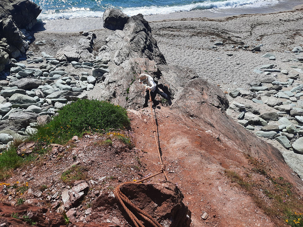
As you make your way onwards, look out for a path leading off left (lead photo) along a steep-sided narrow ridge. It ends by a little waterfall and is a great picnic spot. But be warned: a slip here and you’re unlikely to survive the fall. And if by some unfortunate miracle you do, you’ll be in no fit state to fend off the crabs that'll come in to finish you off with the tide. Just saying.
Presuming you risked/survived the ridge or gave it a miss (wise), the next accessible beach is Venerick's Cove. Bigger than Elender but with grey shingle rather than golden sands that are still to come, it doesn't quite have the wow factor of its neighbour, but, if you like privacy there's plenty of hideyholes between the rocks. And, as it's a nudist beach and overlooked, you might like privacy.

Another word of warning: the last bit of the descent is steep enough to require a rope (kindly provided).
Once you've had your mankini-free moment, it's time to get dressed, climb back up to the coast path and carry on west. Probably in need of a drink now, it won't be long. First tho, down a grassy bank on your left, there's another offshoot path. It leads to another steep-sided ridge and dead end. Narrower and therefore more dangerous than the first, as before, you'd be wise to give it a miss.

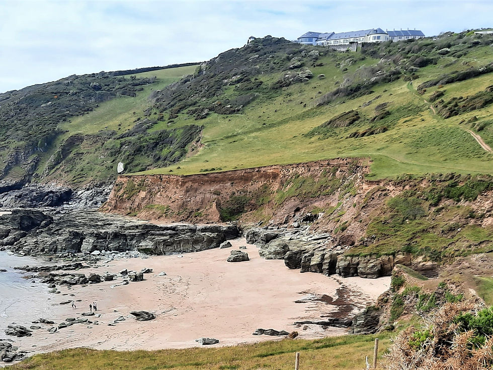
The easiest beach to access comes next. A great spot below Gara Rock Hotel. It's often windy, and the fine sand can get in your eyes but, if
you're able to open them, you'll see the hotel with its small round lookout hut out front.
This hotel was once rather shabby - although it had character and a great basement bar. Now, with millions spent on it, it's rather posh. Nevertheless, it remains welcoming, and the view from the restaurant is fabulous.

As your probably saw on the information board at the car park where you started, there are circular walks. Personally, I think the coastline is worth sticking to for the return journey. It always looks different (changes to light and tide make a big difference) and has so much more to offer than the field and lane alternatives.
After your walk, don't miss a stop at East Prawle village. It has a slightly 'Straw Dogs' feel about it, but, in such a remote area with little available housing, it's understandable second homers and tourists in holiday lets are a little resented by locals - or maybe I'm imagining it.

Actually, I think I was. When I called in the Pigs Nose pub a few days ago, they could not have been friendlier. Great pint too. It's particular good in winter by a roaring fire.


Comments